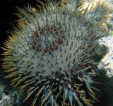
1. Bu Tinah Shoals

2. Dead Sea

3. Angel Falls

The Belize Barrier Reef in the Caribbean is the longest barrier reef in the northern hemisphere and the world's second largest reef system - after the Australian Great Barrier Reef. It extends from the Yucatán Peninsula to Belize (formerly British Honduras). A large number of coral islands line the 256 km of reef and offer opportunities for all types of water sports, including anglers, divers and snorkelers. The reef is home to over 350 species of fish. Along the Belize Barrier Reef are many small islands called Cayes. The best known are Ambergris Caye, Caye Caulker, Blackadore Caye and Long Caye, historically significant is St. George's Caye. The abundance of fish is also used for commercial fishing. Some of the islands and reef sections are protected as a national park or marine reserve. These include the Bacalar Chico and Laughing Bird Caye national parks, the Great Blue Hole, Half Moon Caye national parks, South Wather Caye, Glover's Reef and Sapodilla Cayes reserves. These areas are listed by UNESCO in 1996 as World Heritage.
5. Black Forest

6. Bay of Fundy National Park

7. Cliffs of Moher

Hydrothermal vents are cracks on the surface of the planet that geothermal heat the waters. Hydrothermal ventilation is commonly found near volcanically active areas, areas where tectonic plates move. An April 2007 exploration of the deep-sea vents off the coast of Fiji found those vents to be a significant source of dissolved iron.
El Yunque National Forest is the only tropical rain forest in the United States. The area of El Yunque is 28,000 hectares. This forest is home to more than 240 species of trees (23 of which are unique to El Yunque), 50 species of birds (including rare and threatened Puerto Rico Parrots), and more than 1200 species of insects. El Yunque rain forest recognized by UNESCO as Biosphere official reserve in the year 1976. Because of the amazing forests, the wealth of fresh water and the various species that sustain it, the El Yunque rain forest was chosen as one of only 28 finalists in the Seven New Natural Wonders of Nature. The El Yunque National Rainforest is of course quite proud of its 24 mile recreation of pedestrian paths, via paved roads leading to various mountain peaks, while observing the La Coca Falls waterfall, which is amazing at an altitude of 85 feet, this high waterfall flowing over rock giant stone.
10. Galápagos Islands

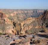
11. Grand Canyon National Park
The Great Barrier Reef is the largest coral reef in the world, with more than 2900 reefs and 900 islands stretching from Bundaberg to the tip of the Cape York Peninsula is over 2,600 kilometers over an area of 344,400 km. The reef, located in the Coral Sea of Queensland, Australia, is also visible from the space, it is the largest living biogenic structure in the world created by living organisms, built by billions of tiny organisms, known as polyp corals. It supports a wide variety of marine life and is listed on the World Heritage in the List of UNESCO in 1981. CNN 's accredits as one of the Seven Wonders of the World. The Queensland National Trust names it as one of the icons of Queensland.
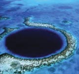
The Great Blue Hole is an underwater collapse pit off the coast of Belize. The hole is located near the Lighthouse Reef center, a small atoll that is 70 kilometers (43 mi) from mainland and Belize City. Holes in a circular shape, more than 300 meters (984 ft) across and within 124 meters (407 ft). This hole formed during several Quaternary glaciation events when sea levels were much lower - an analysis of the discovery of stalactites in the Great Blue Hole showed the formation that had occurred 153,000, 66,000, 60,000 and 15,000 years ago. At the end of the last glacial period it was formed in the limestone layers and forms an access to an underground cave system, which was flooded by the rising sea level. At about 90 meters depth there is a hydrogen sulphide-containing thermocline. The Great Blue Hole was declared in 1996 a national monument.
The Ha Long Bay in Portuguese: "Where the Dragon enters the Ocean", with about 1,969 islets of limestone that rise from the water, is the most famous bay of Vietnam. Most of the islands are not inhabited or affected by human presence. The scenic beauty of the site is complemented by its biological interest. The islands have an endless number of beaches and caves. According to legend, when a great dragon that lived in the mountains ran to the sea, its tail dug valleys that later were filled with water, leaving only pieces of earth to the surface, that is to say, the numerous islands that are sighted in the bay. Ha Long Bay was declared World Heritage by UNESCO in 1993.
Iguazu Falls is a group of about 275 water falls on the Iguaçu River in the Paraná River Basin, located between the Iguaçu National Park, Paraná, Brazil, and the National Park Iguazú in Misiones, Argentina, on the border between the two countries. The total area of both national parks corresponds to 250 thousand hectares of subtropical forest and is considered as Natural Heritage of Humanity. The Argentine National Park was created in 1934, while the Brazilian park opened in 1939. Both protected areas in order to manage and preserve the wealth of water that represents that cataract and the entire environment around them. The parks, both Brazilian and Argentine, became World Heritage sites in 1984 and 1986, respectively. Since 2002, the Iguaçu National Park is one of the Brazilian geological sites. Historically, the first European to find the Iguaçu Falls was the Spanish Álvar Núñez Cabeza de Vaca, in the year 1541. It is currently the second most visited place by foreigners in Brazil.
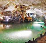
16. Jeita Grotto
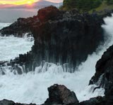
According to ancient Chinese historical records, in the 3rd century AD, Jeju Island was an independent kingdom called Tamna. At that time Tamna had established trade relations with the three Han States on the Korean Peninsula. From the 5th to 9th centuries, Tamra also established trade relations with the kingdoms of Goguryeo, Silla, Tang Dynasty and Japan. In 1105, Tamra was absorbed in the territory of the Goryeo Dynasty during the reign of King Gojong(enthroned 1215-1259) and renamed Jeju.
18. Kilimanjaro National Park
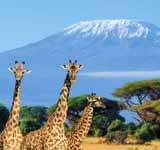
19. Komodo Island
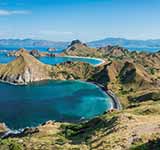
20. Lake Baikal

21. Masurian Lake District
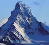
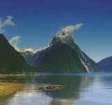
The Matterhorn is a remote mountain. Because of its position in the main Alpine watershed and high altitude, the Matterhorn faces rapid weather changes. Aside from steep mountain faces and remote locations that make it vulnerable to cloud formation with air flowing around and creating a vortex, condensing air. The Matterhorn was the last peak of the Alpine which was conquered and the first ascent marked the end of the Golden alpinism era, namely in 1865 by an expedition led by Edward Whymper and ended tragically when most of its members fell. The Matterhorn is one of the deadliest peaks in the Alps from 1865 "when it was first ridden" until 1995, 500 alpinists died on it. The Matterhorn is a symbol of the Alps in general. Since the end of the nineteenth century, when trains were built, attracting more visitors and climbers. Every summer many skilled mountaineers try to climb the Matterhorn through the north-east ridge line of Hörnli, the most visited route to the summit.
23. Milford Sound
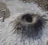
24. Mud Volcanoes
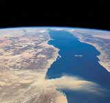
25. Northern Red Sea
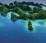
Palau, officially Republic of Palau is a small island country of Micronesia, in the Pacific Ocean, between the Philippines to the west and north, Indonesia and Papua New Guinea to the south and Federated States of Micronesia to the east and northeast. The country was originally established about 3,000 years ago by migrants from the Philippines having suffered a settlement of negritos until about 900 years ago. The islands were visited by Europeans in the 18th century and became part of the Spanish Empire in Asia in 1885. After Spain's defeat in the Hispano-American War in 1898, the islands were sold to Imperial Germany in 1899. under the German-Spanish Treaty, where they were administered as part of New Guinea. The Imperial Japanese Navy conquered Palau during World War I, and the islands were later made a part of the South Pacific Mandate by the League of Nations.
27. Sundarbans
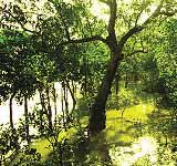
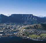
Table Mountain is a mountain whose peak is flat like a table. This mountain is included in the area of the Gunung Meja National Park, located in the city of Cape Town, South Africa, and is one of the leading tourist attractions in the city.
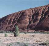
Uluru, also known as Ayers Rock, is a large rock formation in Uluru-Kata Tjuta National Park, about 350 km southwest of the city of Alice Springs, Northern Territory, Australia. Uluru is a sacred object for Aborigines with many springs, caves and primitive paintings. Uluru is one of Australia's most famous natural icons. The world-famous sand formation stands 348 m (1142 ft) high (863 m/2831 ft above sea level) with most of the mass below the ground, and the circumference size is 9.4 km (5.8 mi).
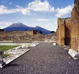
30. Vesuvius National Park
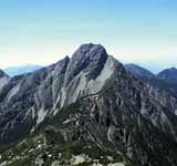
31. Yushan National Park
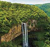
32. Amazon rainforest
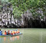
Puerto Princesa Underground River National Park is a protected area located 80 kilometers north of Puerto Princesa City, Palawan, Philippines. In 2010, a group of environmental activists and geologists discovered that this underground river had a second floor, indicating that there was a small waterfall inside the cave. They also found a cave dome measuring 300 m above the underground river. The deeper area of the underground river is almost impossible to explore because of low oxygen levels.

